Welcome to the tutorial: mapping burned area with Deep Learning
About the tutorial
This tutorial is an effort to provide processing code strings for the purpose of using Deep Learning architectures for land cover disturbance mapping, combining Google Earth Engine and Google Colab. This material essentially focuses on mapping burned areas at a regional scale, so that it can be replicated for local or larger scale work.
Wildfire
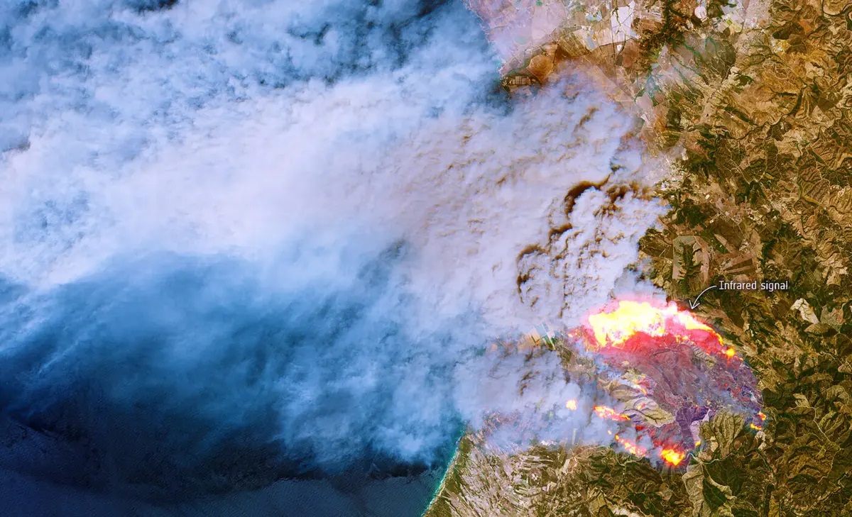
Human actions are driving significant changes in land cover, intensifying climate change challenges and posing critical threats to communities and ecosystems. These changes arise from various processes and drivers, operating at different scales. It is crucial to capture these diverse processes explicitly in space and time to support scientific and societal applications that go beyond mere geographic representation of disturbances. Wildland fires offer a unique chance to study the role of abrupt land cover change, gradual recovery, and the establishment of new equilibria. Satellite remote sensing provides valuable data on fire location, magnitude, and recovery.
For future citations of this work, please use:
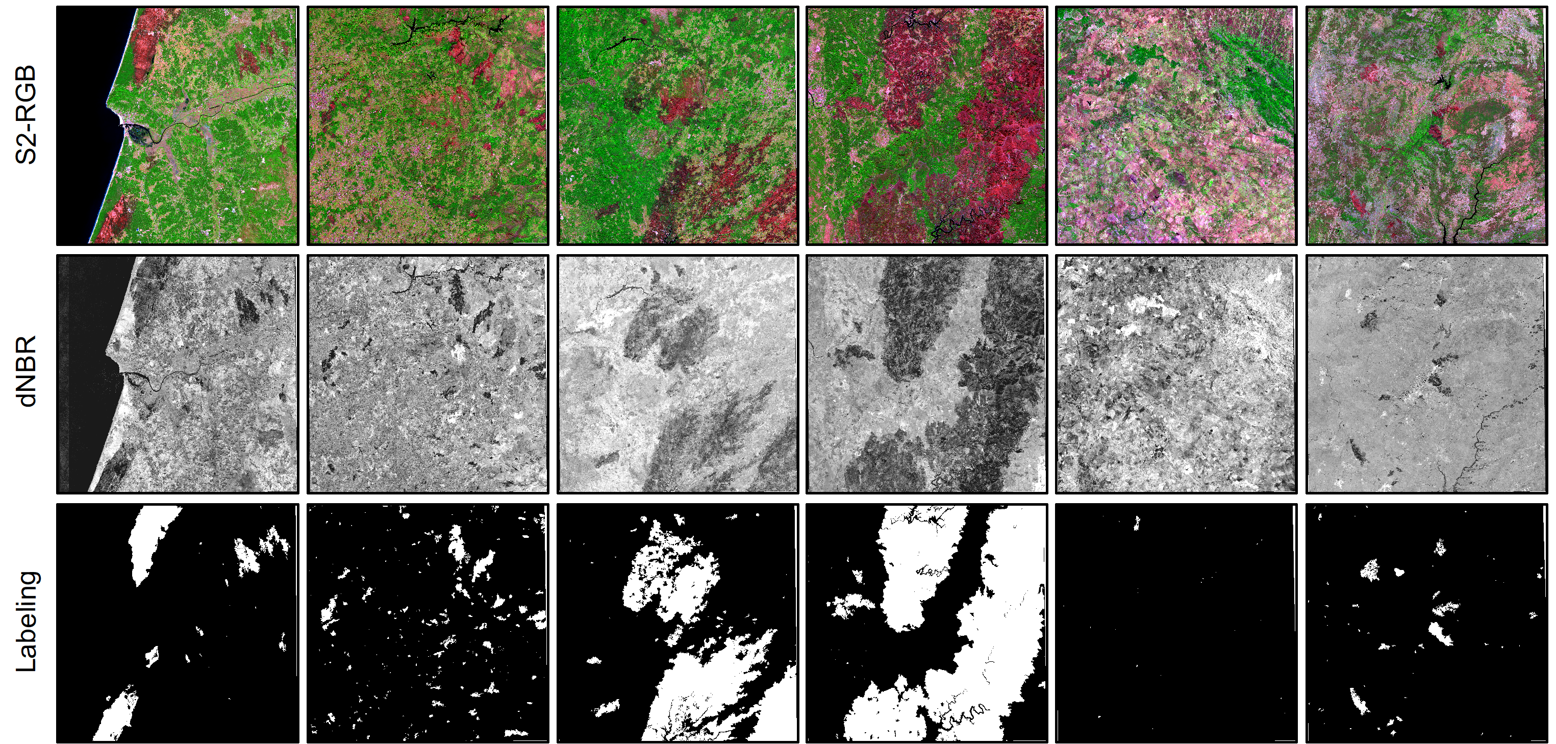
Some Sentinel-2 burned areas patches