🌍 Normalized Radar Burn Ratio: Global Burn Scar Mapping
About NRBR
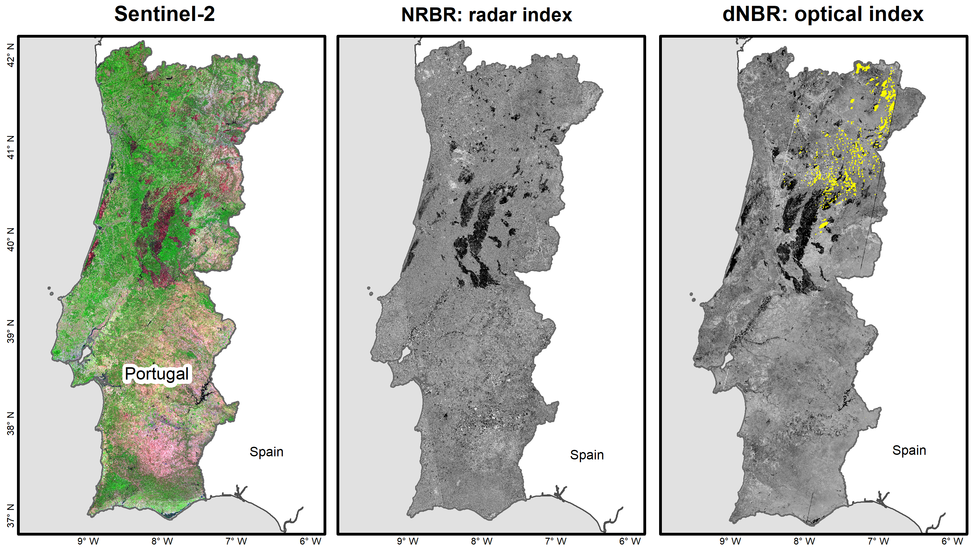
🔥 The Normalized Radar Burn Ratio (NRBR) Index is an innovative tool that maps burn scars using Sentinel-1 C-SAR data, overcoming cloud cover and smoke limitations. By fusing radar (Sentinel-1) and optical (Sentinel-2) imagery, we deliver robust, all-weather burn scars assessments for:
- Global monitoring in cloud-prone regions.
- Multi-sensor synergy: Enhanced accuracy via SAR’s penetration + optical’s spectral resolution.
- Rapid response: Day/night detection, critical for post-fire recovery.
- Ecosystem resilience: Data-driven restoration prioritization.
🛰️ Why radar?
While optical sensors (e.g., Sentinel-2) rely on sunlight, Sentinel-1’s C-band radar reveals structural changes in burned vegetation—rain or shine. The NRBR algorithm leverages this advantage, transforming raw data into actionable insights for researchers, agencies, and decision makers.
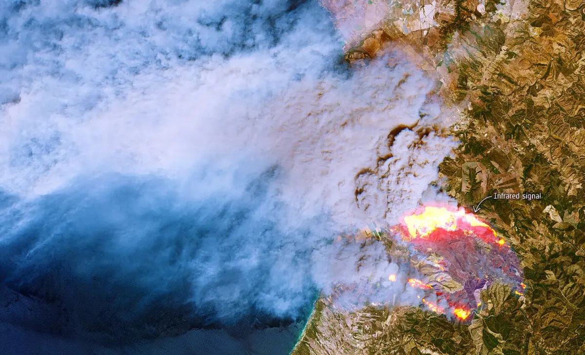
🚀 Wildfires leave scars—track them with satellite intelligence.
🚀 Explore, contribute, or deploy locally. Turn pixels into impact!